

BIM og mengdeberegning
Get 6D carbon from a BIM model
Turn a converted BIM model into an embodied carbon footprint. Auto-enrich reads quantities…
5 trinn12 minÅpne
Last inn en laserskannet punktsky av eksisterende forhold, mål avstandene, arealene og volumene du trenger rett fra oppmålingen, før dem inn i mengdeuttaket og pris arbeidet.
4 trinn gjennom plattformen - hva du gjør i hvert og hvorfor det betyr noe.
Last inn punktskyen av de eksisterende forholdene og orientér deg i den, og sjekk at skanningen dekker områdene du trenger å måle uten store skygger eller hull.
Hvorfor: En skanning med et hull der du trenger et mål er verre enn ingen skanning, fordi du først finner det ut ved måletidspunktet. Å sjekke dekning først sparer en bortkastet retur til plassen.
Mål avstandene, vegg- og gulvarealene, romhøydene og volumene du trenger direkte på skyen, ved å lese dem av den reelle geometrien framfor en tegning.
Hvorfor: Eksisterende bygg er aldri i vinkel eller i lodd slik en tegning later som. Å måle den som-bygget-virkeligheten er det som holder en rehabiliteringsmengde ærlig og prisen bak den trygg.
Bring de målte dimensjonene inn i mengdeuttaket som kildemengdene for arbeidet, og behold koblingen tilbake til hvor hver enkelt ble målt.
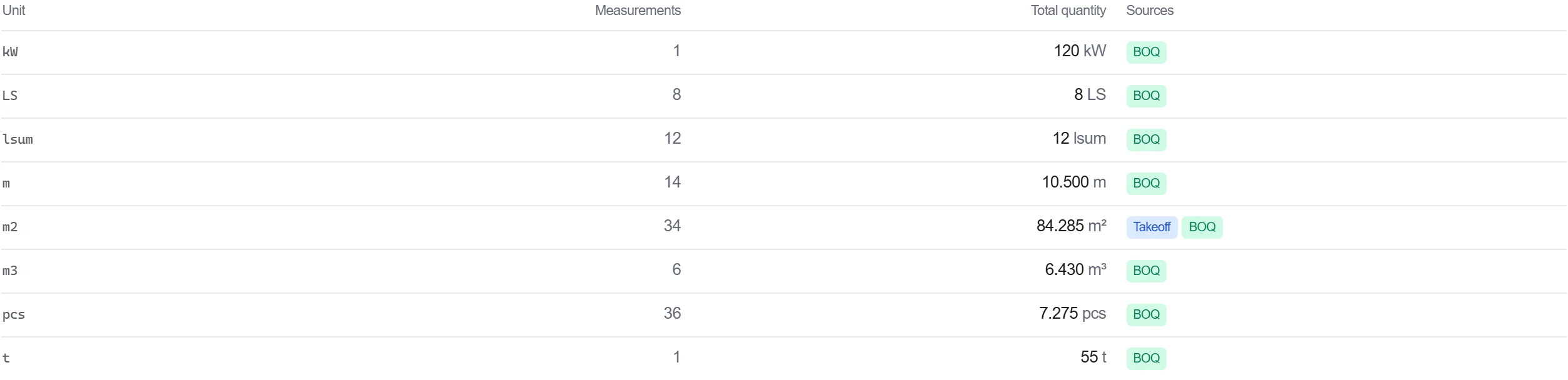
Hvorfor: En mengde som spores tilbake til et punkt på oppmålingen er forsvarlig. Når noen stiller spørsmål ved et tall, kan du åpne skyen og vise målingen det kom fra.
Pris det målte arbeidet i mengdelisten, slik at de oppmålingsbaserte mengdene flyter rett inn i en kostnad uten en ny inntasting imellom.
Hvorfor: Å bære skannemålinger gjennom til mengdelisten holder én ubrutt kjede fra det reelle bygget til prisen. Hver manuelle kopi i den kjeden er en sjanse til å innføre en feil.
3 / 190 plattformmoduler
Turn a converted BIM model into an embodied carbon footprint. Auto-enrich reads quantities…
Load a converted model, lift the element quantities straight off the geometry, carry them i…
Load a DWG, lock the scale against a known dimension, measure the areas, lengths and counts…