

BIM y medición
Get 6D carbon from a BIM model
Turn a converted BIM model into an embodied carbon footprint. Auto-enrich reads quantities…
5 pasos12 minAbrir
Carga una nube de puntos de escáner láser del estado actual, mide directamente sobre el levantamiento las distancias, superficies y volúmenes que necesitas, llévalos a la medición y valora la obra.
4 pasos a lo largo de la plataforma - qué hacer en cada uno y por qué importa.
Carga la nube de puntos del estado actual y oriéntate en ella, comprobando que el escaneo cubre las zonas que necesitas medir sin grandes sombras ni huecos.
Por que: Un escaneo con un hueco justo donde necesitas una cota es peor que no tener escaneo, porque solo te enteras a la hora de medir. Comprobar antes la cobertura ahorra una vuelta perdida a la obra.
Mide directamente sobre la nube las distancias, las superficies de muros y suelos, las alturas de las estancias y los volúmenes que necesitas, leyéndolos de la geometría real y no de un plano.
Por que: Los edificios existentes nunca están a escuadra ni a plomo como finge un plano. Medir la realidad tal como está construida es lo que mantiene honesta una cantidad de rehabilitación y seguro el precio que hay detrás.
Lleva las dimensiones medidas a la medición de cantidades como cantidades de origen de la obra, conservando el vínculo con el punto donde se midió cada una.
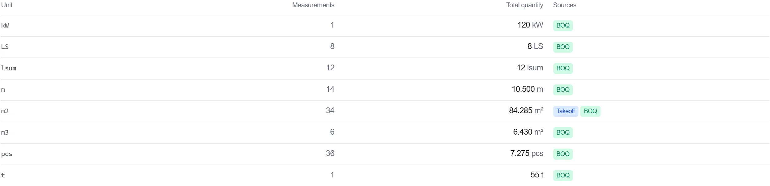
Por que: Una cantidad que se remonta a un punto del levantamiento es defendible. Cuando alguien cuestiona una cifra, puedes abrir la nube y mostrar la medición de la que salió.
Valora la obra medida en el presupuesto, para que las cantidades basadas en el levantamiento fluyan directamente a un coste sin un reteclado por medio.
Por que: Llevar las mediciones del escaneo hasta el presupuesto mantiene una cadena ininterrumpida desde el edificio real hasta el precio. Cada copia manual en esa cadena es una oportunidad de introducir un error.
3 / 190 módulos de la plataforma
Turn a converted BIM model into an embodied carbon footprint. Auto-enrich reads quantities…
Load a converted model, lift the element quantities straight off the geometry, carry them i…
Load a DWG, lock the scale against a known dimension, measure the areas, lengths and counts…