

BIM và bóc tách khối lượng
Get 6D carbon from a BIM model
Turn a converted BIM model into an embodied carbon footprint. Auto-enrich reads quantities…
5 bước12 phútMở
Nạp một đám mây điểm quét laser của hiện trạng, đo các khoảng cách, diện tích và thể tích bạn cần thẳng từ khảo sát, đưa chúng vào bóc tách khối lượng và định giá công việc.
4 bước xuyên suốt nền tảng - bạn làm gì ở mỗi bước và vì sao điều đó quan trọng.
Nạp đám mây điểm của hiện trạng và định hướng trong nó, kiểm tra bản quét có bao phủ các khu vực bạn cần đo mà không có bóng lớn hay lỗ hổng.
Tại sao: Một bản quét có lỗ hổng ở nơi bạn cần một kích thước còn tệ hơn không có bản quét, vì bạn chỉ phát hiện lúc đo. Kiểm tra độ bao phủ trước tiết kiệm một chuyến quay lại hiện trường vô ích.
Đo các khoảng cách, diện tích tường và sàn, chiều cao phòng và thể tích bạn cần trực tiếp trên đám mây, đọc chúng từ hình học thực chứ không phải một bản vẽ.
Tại sao: Các công trình hiện hữu không bao giờ vuông vắn hay thẳng đứng như một bản vẽ vờ như vậy. Đo thực tế hoàn công là điều giữ cho khối lượng cải tạo trung thực và mức giá đằng sau nó an toàn.
Đưa các kích thước đã đo vào bóc tách khối lượng làm khối lượng nguồn cho công việc, giữ liên kết trở lại nơi mỗi cái được đo.
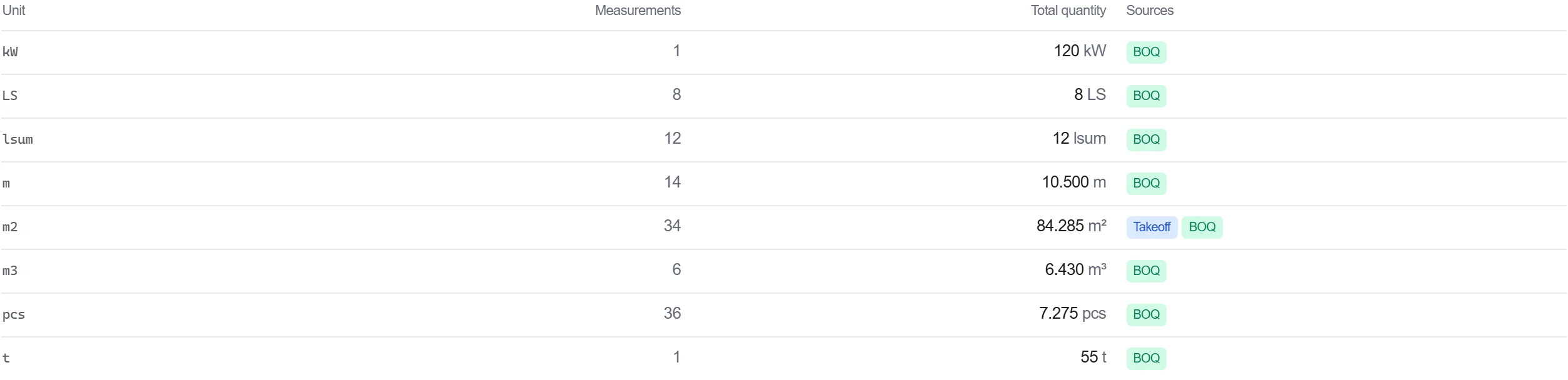
Tại sao: Một khối lượng truy vết trở lại một điểm trên khảo sát thì có thể bảo vệ được. Khi ai đó chất vấn một con số, bạn có thể mở đám mây ra và cho thấy phép đo mà nó đến từ đó.
Định giá công tác đã đo trong bảng khối lượng, để khối lượng dựa trên khảo sát chảy thẳng vào một chi phí không phải gõ lại ở giữa.
Tại sao: Đưa phép đo quét đến tận bảng khối lượng giữ một chuỗi liền mạch từ công trình thực đến mức giá. Mỗi lần sao chép thủ công trong chuỗi đó là một cơ hội đưa vào một lỗi.
3 / 190 mô-đun nền tảng
Turn a converted BIM model into an embodied carbon footprint. Auto-enrich reads quantities…
Load a converted model, lift the element quantities straight off the geometry, carry them i…
Load a DWG, lock the scale against a known dimension, measure the areas, lengths and counts…